
Benvenuti dvlp in Italia 🇮🇹
Italy is live on dvlp. Grid bottlenecks, landscape protection requirements, terrain constraints, Natura 2000—all the relevant layers for site screening in Italy, ready to use immediately.
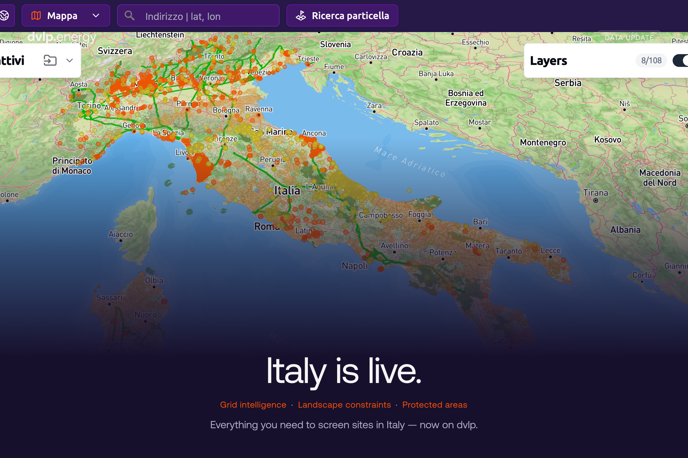
Italy is a land of mountains, rivers, and sea, with countless historical sites and protected areas in between. This is precisely what makes Italy one of the most beautiful places in the world to live and travel, while simultaneously making it one of the most challenging countries for developing new energy infrastructure.
We are therefore pleased to announce that the dvlp web-GIS is now available in Italy. Whether for solar, storage, wind, or data center projects, you can now easily identify and evaluate potential sites and carry out all the steps necessary for successful project development.
From an undeveloped plot to a validated project — in just a few clicks
The workflow is incredibly simple. Search for an address or a specific plot of land, create a project, and start an automated site assessment. The platform highlights all planning and legal restrictions, calculates the usable net area, enables the export of cadastral data and the uploading of owner information — and displays the entire project in 3D. What used to mean switching between a dozen regional portals and various GIS applications can now be done in one single place.
And it comes with an extensive database right from the start. Over 100 central datasets are already available, covering administration, power grids, energy infrastructure, transport, environmental protection, hydrology, topography, land use, and regional spatial planning. Here is a look at how some of these apply to the Italian project landscape:
Protected areas
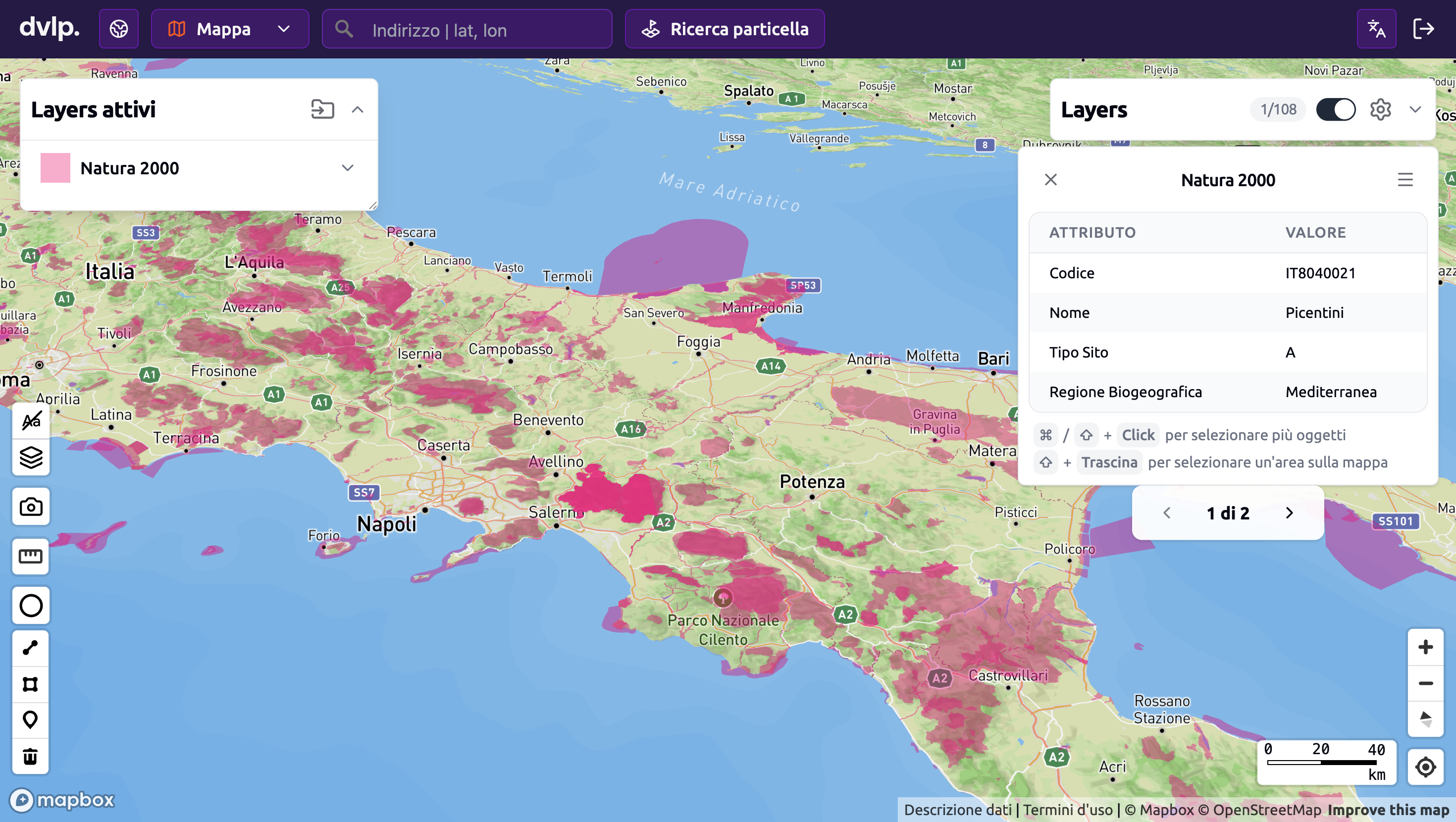
From the peaks of the Apennines to the coastal wetlands where migratory birds rest, many of Italy's most beautiful landscapes are also among its most strictly protected. Project developers must therefore navigate the Italian nature conservation framework: national and regional parks, nature reserves under Law 394/1991, European Natura 2000 sites — including SACs and SPAs — as well as other designations such as Important Bird Areas and Ramsar wetlands, complemented by forests and geotope protections.
The mountains
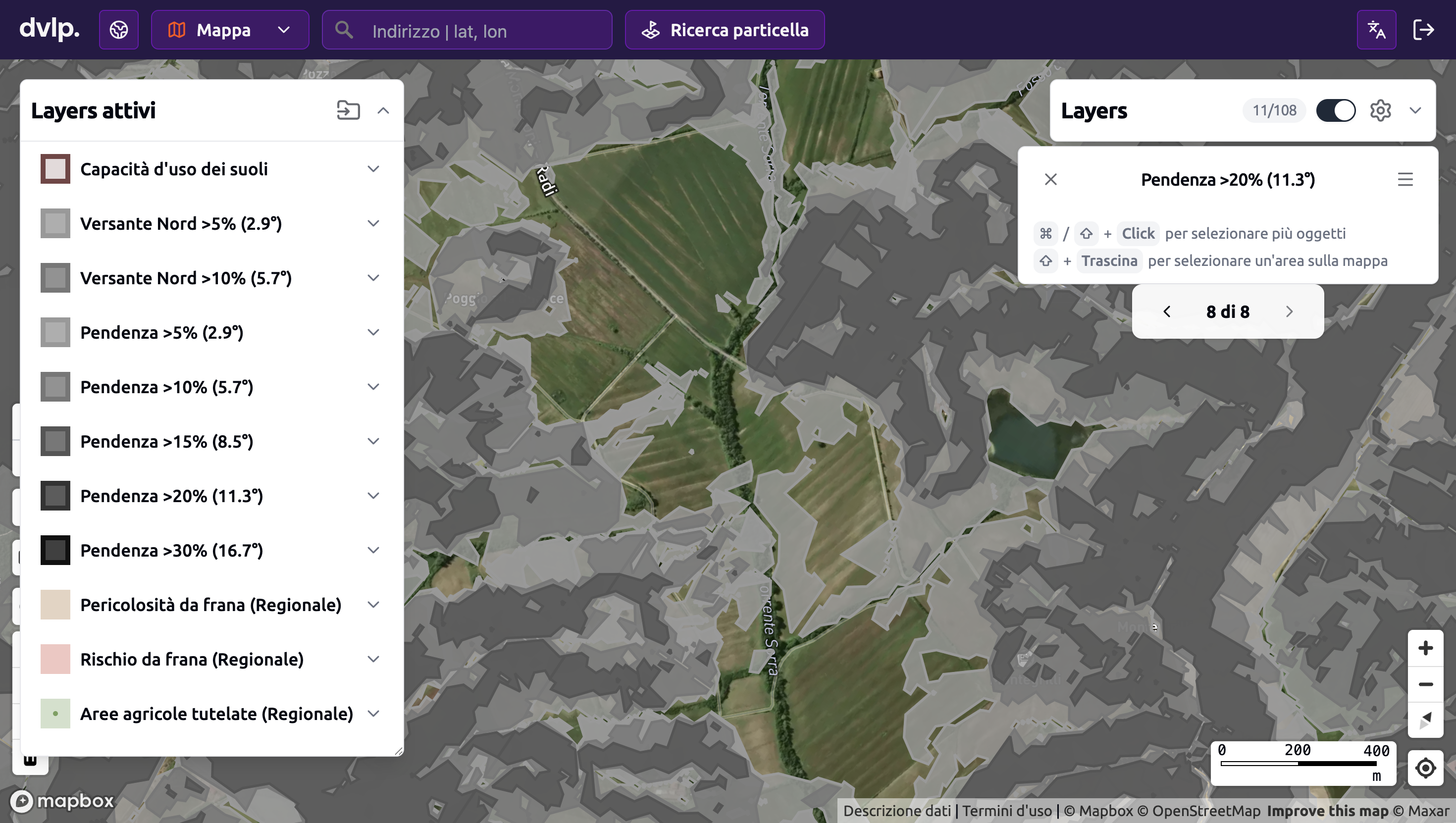
In Italy, topography is a decisive factor in where projects are feasible. Our slope layers classify gradients from >5% up to >30% — supplemented by dedicated layers for north-facing slopes, where utility-scale PV is not economically viable.
The rivers, the sea, and the historical heritage in between
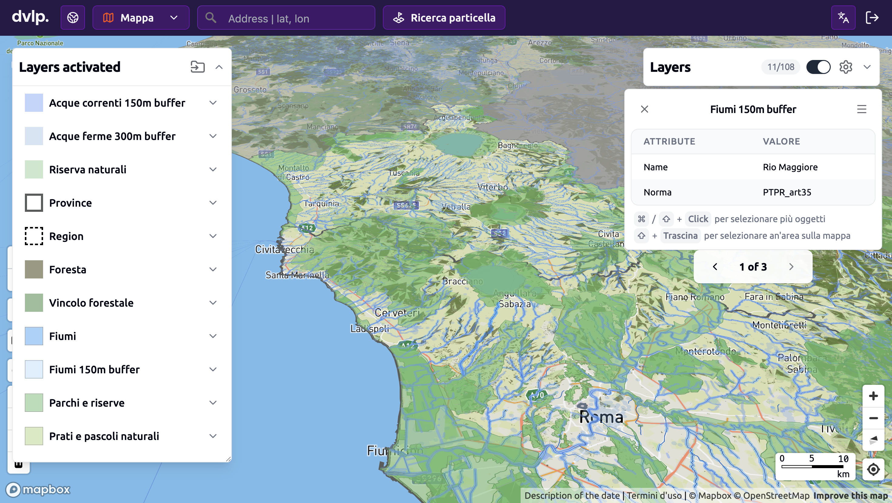
This is where things get particularly complex in Italy — and where the *Pianificazione territoriale e paesaggistica regionale* comes into play. Harmonized from various regional plans, it maps the *vincoli paesaggistici* (landscape constraints) that shape much of the project development in Italy. A protection distance of 150 m applies along watercourses, 300 m near lakes, and 300 m along the coast. Forests, high mountains, glaciers, historic town centers, scenic roads, and designated cultural monuments each appear as separate layers. Since landscape approval is one of the biggest bottlenecks in the Italian permitting process, identifying these restrictions early on can mean the difference between a viable site and years of delays.
… and the grid
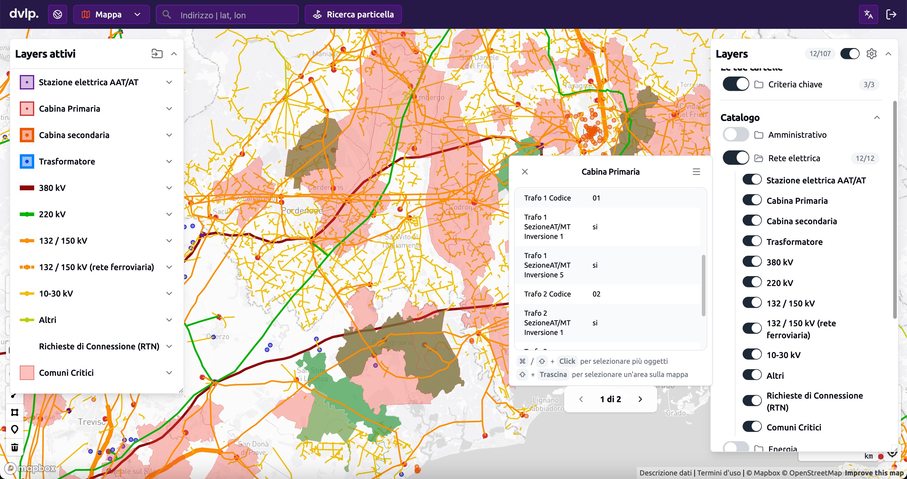
An ideal location is worthless if a grid connection isn't possible—which is why dvlp also integrates grid information into the same view. For every primary substation, you can see the feed-in share per transformer, classified by >1% and >5%—an early indicator of how much decentralized feed-in the grid is already handling. The Comuni-Critici layer highlights all municipalities where a distribution-level grid connection is considered problematic by the distribution system operator (DSO), allowing bottlenecks to be identified early and sites with available grid capacity to be prioritized.
Get started now
dvlp is now live in Italy—and we will be adding new datasets and features every month.
Would you like to see how the platform applies to your projects? Book a demo and we will walk you through the platform together.
Welcome—and see you soon in the land of mountains, rivers, and the sea—with plenty of sustainable, reliable, and cost-effective energy projects in between. ☀️💨🙂
More blog posts


Request a demo now

